- Secondary Electron Microscopy Images of Soil Samples(c) 2023 SoilCarbonHack

SoilCarbonHack
This page serves as introduction to the project SoilCarbonHack and gives an overview over available resources and past and upcomming events. The following links will take you directly to the most important information and resources:
Content
Project Description
In cooperation with the Chair of Soil Science at the Technical University of Munich, we aim to apply data-driven methods and models of Spatial Data Science to NanoSIMS data in an interdisciplinary way through new spatial algorithms and data structures, software and infrastructures, in order to gain innovative insights into scientifically and societal significant storage mechanisms of organic carbon in soils. Through relevant participation of early-career scientists in the project team, a hackathon, and a methods workshop, we aim in particular to contribute to the perpetuated application in the scientific community.
Background
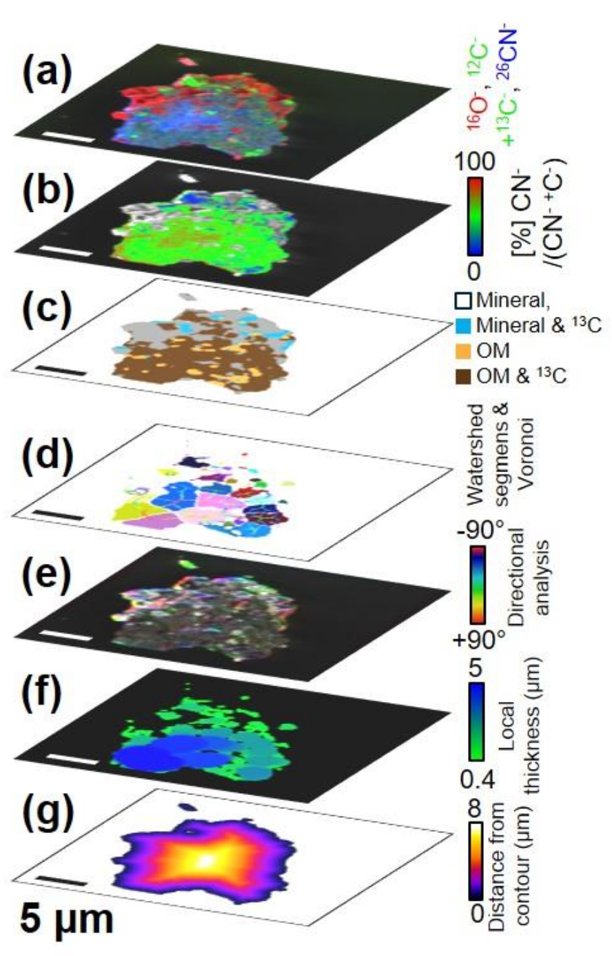
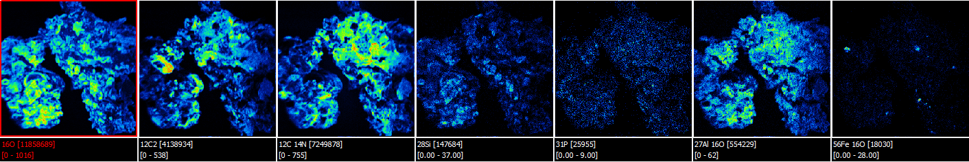
Our knowledge on the storage of organic carbon in soils has changed drastically after discovering that the spatial arrangement in soil microstructures and mineral binding partners can contribute to carbon storage. However, an overarching understanding of the extent to which the spatial arrangement of soil microstructures causes locally different turnover of carbon and how much this affects soil fertility indifferent ecosystems lags behind the wealth of data from new spectromicroscopic analyses. With the help of a nano-scale secondary ion mass spectrometer (NanoSIMS), the Chair of Soil Science at the Technical University of Munich has been able to gain novel insights and individual findings on the importance of the complex biogeochemical arrangement of soil microstructures for the turnover of organic carbon.
In order to develop a understanding across ecosystems, novel methods and data tools are needed to enable the identification of functionally connected spatial patterns and their importance for carbon dynamics. A development and adaptation of spatial data mining methods, as already widely applied within remote sensing, will enable sustainable impulses of data science in the field of soil science.
AI4Soil
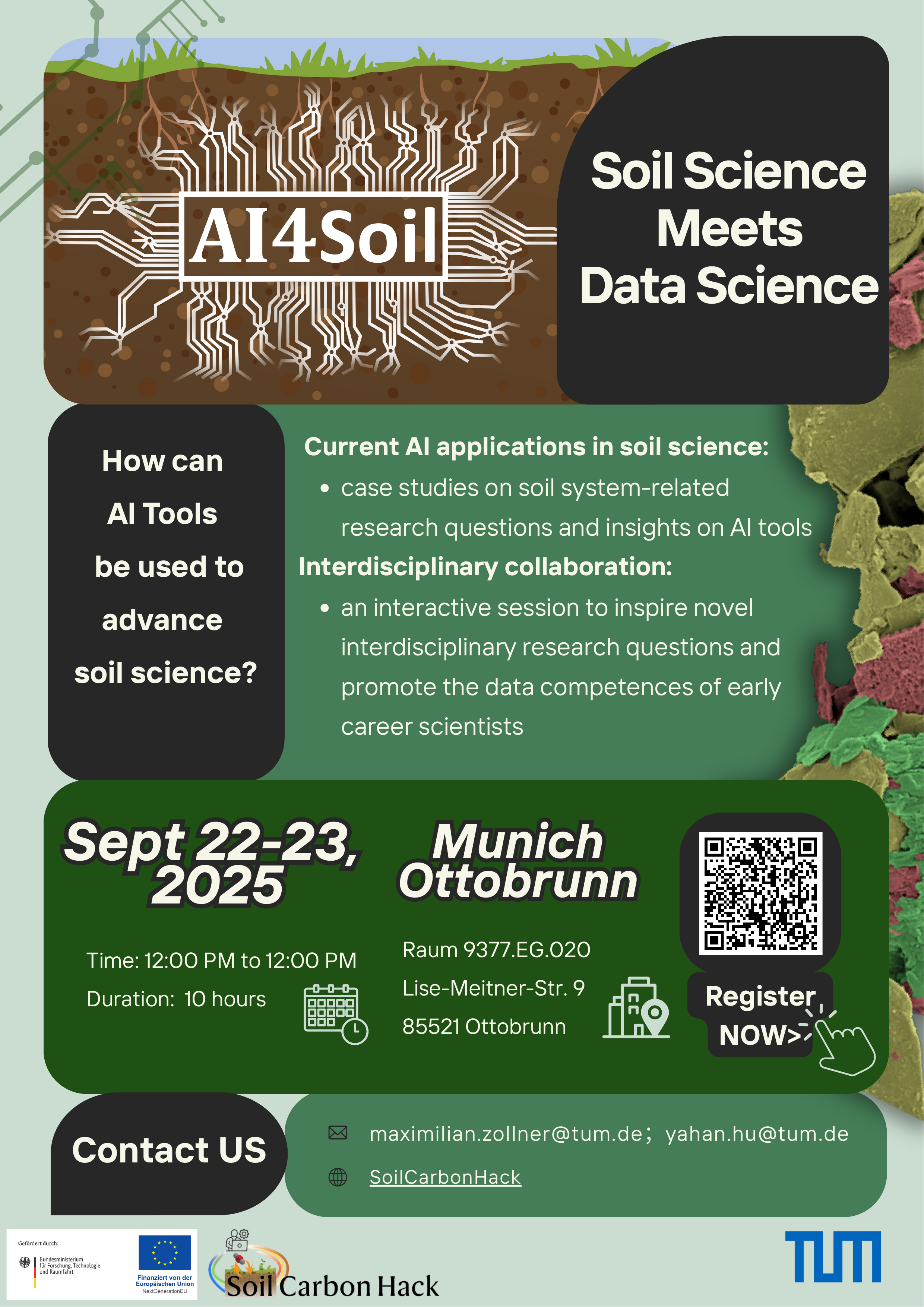
Together with the TUM Chair of Soil Science, the Professorship Big Geospatial Data is hosting a workshop with keynotes on the application of deep learning in soil science and peer consulting.
The event will feature keynote presentations and interactive group discussion sessions designed to facilitate the exchange of participants’ expertise in AI applications within soil science.
We especially encourage early-career scientists to participate and connect with peers and experts in the field.
Check the AI4Soil page for more information.
You can register here.
Resources
Following, you find open educational resources, software, and other material related to the project. For any questions regarding the materials, please contact the respective author(s).
Web-based full-text search engine
We present a web-based full-text search engine. Search through articles related to the SoilCarbonHack project and provided by the TUM Chair of Soil Science. Search for keywords, titles, authors, journals, or any text you are interested in. The search engine is highly scalable and extracts all information from raw PDF files. Documentation and examples can be found here.
Software
Open Education
- OER: NanoSIMS preprocessing (IPYNB)
- OER: NanoSIMS preprocessing (PDF)
- OER: Unsupervised methods for OCCN (IPYNB)
- OER: Unsupervised methods for OCCN (PDF)
- OER: NanoSIMS clustering (IPYNB)
- OER: NanoSIMS clustering (PDF)
- Script to compute clustering entropy
Other
- Poster for NFDI4Earth Academy poster session
- Catalog of publications and related NanoSIMS datasets (work in progress)
SoilCarbonHack(athon)
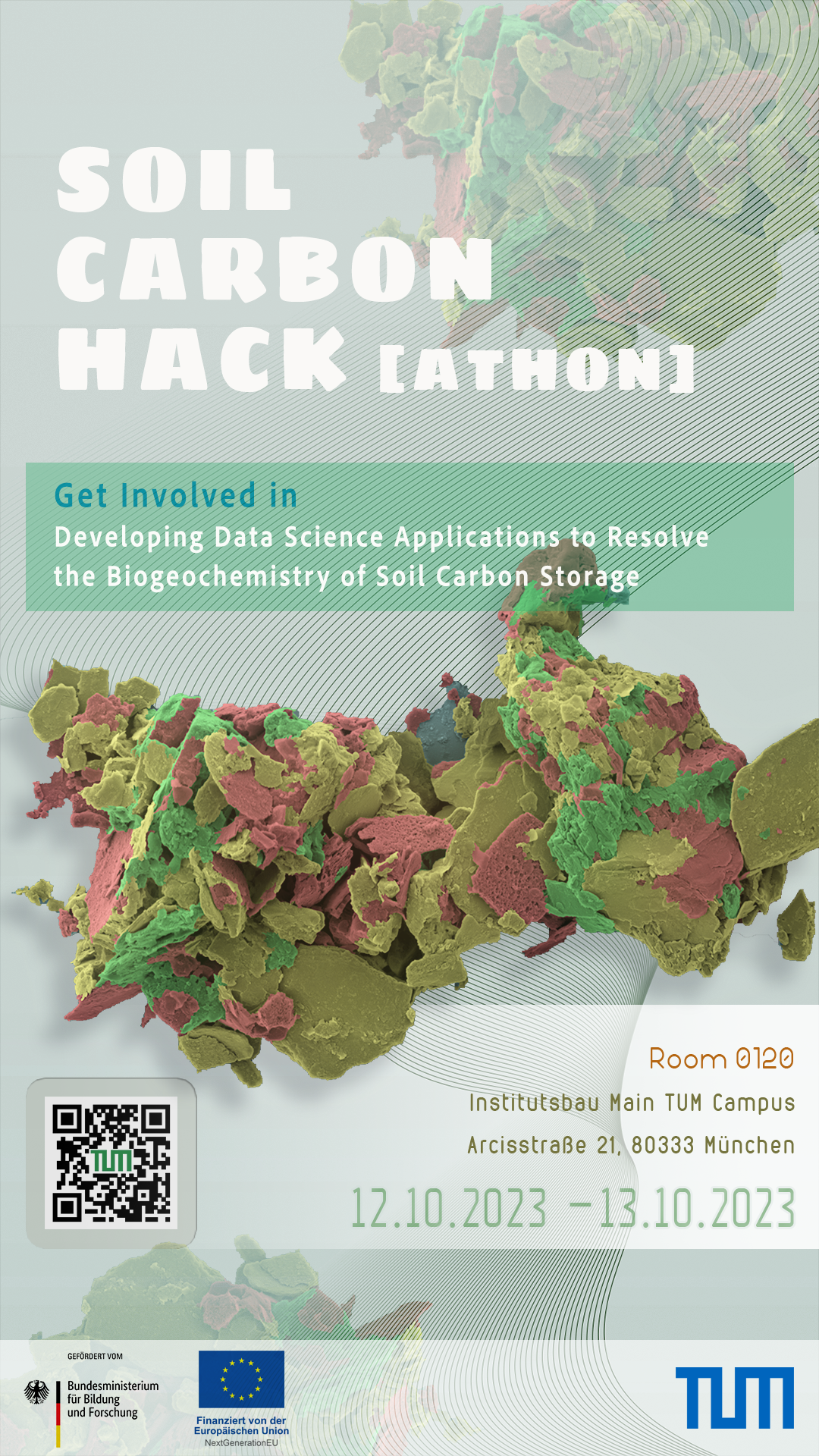
We hosted a Hackathon in October 2023, putting together soil-driven and data-driven minds over microscale NanoSIMS images to improve our understanding of soil carbon storage. Check our hackathon page for infos, images, and related resources.
Contact
Yahan Hu
yahan.hu@tum.de
Chair of Soil Science
Emil-Ramann-Straße 2
85354 Freising
Johann Maximilian Zollner
maximilian.zollner@tum.de
Professorship of Big Geospatial Data Management
Lise-Meitner-Str. 9
85521 Ottobrunn\
Acknowledgement
The project SoilCarbonHack is funded by the Bundesministerium für Forschung, Technologie und Raumfahrt (BMFTR).
Contact
Big Geospatial Data Management
Lise-Meitner-Str. 9
85521 Ottobrunn
martin.werner@tum.de
Getting to us...